


J 7 TMV

lorenzot54
User

Length
44 km

Max alt
833 m

Uphill gradient
1232 m
Km-Effort
60 km

Min alt
204 m

Downhill gradient
1243 m
Boucle
Yes
Creation date :
2022-07-16 06:43:23.0
Updated on :
2022-07-16 20:02:01.37
3h52
Difficulty : Very difficult

FREE GPS app for hiking
 SityTrail
IGN / Geographical institutes
SityTrail Plus
The world is yours!
About
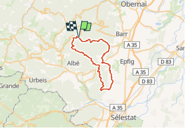
Trail Mountain bike of 44 km to be discovered at Grand Est, Bas-Rhin, Le Hohwald. This trail is proposed by lorenzot54.
Positioning
Country:
France
Region :
Grand Est
Department/Province :
Bas-Rhin
Municipality :
Le Hohwald
Location:
Unknown
Start:(Dec)
Start:(UTM)
376796 ; 5362294 (32U) N.
Comments